Friday, October 5, 2007

October 5, 2007 Chap. 8&9


Friday, October 5, 2007 we had a lecture on Chapter 8 and done Excercises Chapter 8 & 9 in the Arc GIS Book.


Chapter 8 is about Queries.

Queries are select by attribute or location.


Text always has single quotes around it. Example, 'TEXT'


Tables contain attribute data. Shapefiles, coverage, and geodatabase


You have Attribute tables and Standalone tables.


Attribute Tables has the shapfield for a dead giveaway.


Sources, fields, Field types, Field Characteristics, editing fields are part of working with queries.


Table cardinality is how may objects are related to each other.


one to one. One to many


many to one. Many to many


Join = one to one, Relate = one to many.


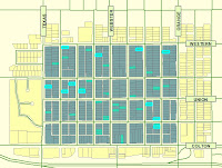
Example of Chapter 8 is the first picture.


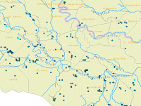
Example of Chapter 9 is the 2nd picture.

Thursday, October 4, 2007


Thursday, Oct.4,2007,

On Friday, September 28, 2007 we discussed Chapter 6, Aerial and Satellite Images.

We also began working on an exercise to tranform a map to real-world coordinates. This exercise includes creating geodatabases and feature classes as well as creating and editing data.

an example is listed to the right.


Friday, September 21, 2007

Friday, September 21, 2007


Today we had lectures on Chapter 4 and chapter 7.


Chapter 4 is about Data Entry. Data Entry is the most expensive and time consuming of GIS. Also Data Entry involves taking infomation from maps and using it effectively. If the information is incorrect the GIS project is worthless.


Chapter 7 is about Digital Data Sources. There is a 3 step process Identify, obtain, and ingest. Digital data sources are web delivered from government sources and a lesser extent private sources. Spatial data formats/datafiles are Coverage, shapefile, and geodatabase.


We also done two chapters in lab today. Chapter 15 and 16.


Wednesday, September 19, 2007


Wednesday, September 19, 2007,

On Friday, September 14, we took our first test, Chapter 1-3. I have relized after taking the test, that I have a lot to learn about the terminology and information provided for GIS.
This will come in due time. We worked on lab during the remainder of class. The handouts have been quite useful for chapter 1 and 3.

Today I have finally learned how to upload the image file to the the post I am writing and change the size of the image.

I am just beginning to understand how popular GIS is becoming and hope to have a better understanding through time.

Thursday, September 13, 2007

GIS111, September 13, 2007

On Friday, September 7, 2007, we had a lecture on Chapter 3. Chapter 3 is about "Geodesy, Datums, Map Projections and Coordiinate Systems. Geoid's is based on the gravitational movement of the earth. "Geodesists have defined the geoid as the three-dimiensional surface along which the pull of the gravity is a specified constant." pg. 73; paragraph 2, GIS Fundamentals.
We also spoke about the test Tommorrow and we were requested to watch the video by ESRI,
Working with Map Projections and Coordinante Systems in ArcGIS. One of the examples used in the video was, how to project data on the fly. The video was informative and the instructor Milita kennedy asked 3 review questions during the presentation.
We also done Chapter 13 and posted the map to our blog.

Wednesday, September 5, 2007

GIS111, August31, 2007

Today we done a review of Chapter 2. The subject matter included Raster and Vector models. The models we will be working with most in class will be Vector. A Vector data model uses a single coordinate pair to represent the location of an entity that is considered to have no dimension, pg. 33 GIS Fundimentals, paragraph 2; Vector Data Models. A Raster Data model define the world as a regular set of cells in a grid pattern. pg. 40 GIS Fundimentals, paragraph 1; models and cells.
We also learned about exporting jpg images and uploading them to our blog. Also, we worked on Chapter 4 and 14 and finished any remaining work at home.
Homework also included Reading Chapter3 and we will work on Chapter 13 inclass.

Friday, August 24, 2007

GIS111 Friday, August 24th 2007 Class

Began GIS111, Pete Kennedy Gave us a lecture on what is GIS.

GIS is two main things Where and What. Anything done in GIS is related to these two things.

GIS uses spatial information each and everyday.

GIS is needed due to the land mass getting smaller due to the population and is used to address social problems today. GIS is also used in urban planning, search and rescue, and public management to name a few.

Also, he gave us instruction on how to use the ARCGIS Software. We done Exercise 3a, 3b, and 3c.

For homework we created out blog and post a message about today. Also, to read Chapters 1&2 in both books.

So far, The class is a good beginning for the simester.